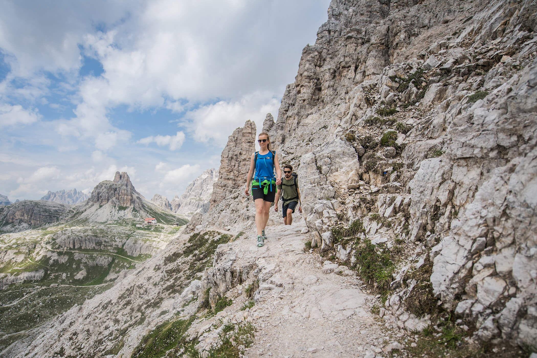
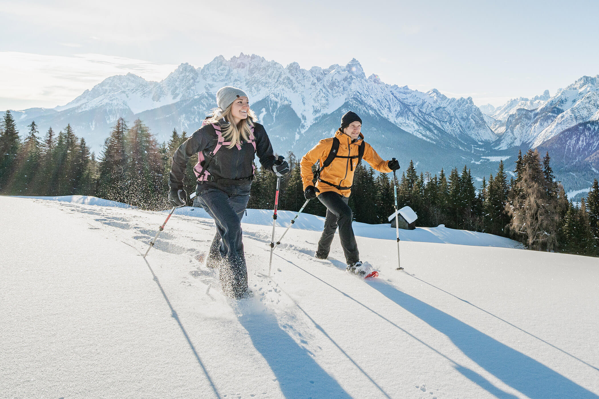
DISCOVER ALL THE VARIETY OF ALTA PUSTERIA!
Whether in pastures bathed in sunshine or on the spectacular peaks of the Dolomites, or even in picturesque corners - walking and hiking in Dobbiaco in the Dolomites is a real pleasure! Around the famous Three Peaks, Lake Landro and at the foot of Mount Serla, the mountain of the people of Dobbiaco, and in woodlands and broad expanses of greenery are many hiking trails, mountain paths and walking trails to suit every taste. This unique combination of fresh air, peace and nature can be found only here at Hotel Laurin in Dobbiaco!
Here are some possible excursions and itineraries at altitude:
They are the landmark of the UNESCO World heritage Dolomites and one of the most popular photo motives of this area: the world famous Three Peaks (Tre Cime di Lavaredo). Who wants to get a picture of the impressive Three Peaks in the South Tyrolean Alta Pusteria should experience the towering trio by foot.
The hiking tour with an elevation gain of 1000 meters starts in Landro, in a 15 kilometer long valley that is called Val di Landro. Here you follow eastwards the path nr 102 until you arrive the head of the valley. Here the path continues through rocky terrain with mountain pines up to the so called Rienzboden on 2.175 meters above sea level. Here you can enjoy an unforgettable view to the Three Peaks and the well known Rifugio Lavaredo (2.405 m) is not far any longer.
Approach: |
Landro - Val di Landro |
Path number: |
102, 101 |
Level of difficulty: |
easy |
Tour length: |
8.538 m |
Walking time: |
3 h 25 min. |
Evelation gain ascent: |
1.000 m |
Evelation gain descent: |
0 m |
It is an easy and not exhausting tour, the two hours walk to the malga San Silvestro. On 1.798 meter above sea level you will enjoy a beautiful and an idyllic atmosphere. The historic-cultural highlight of the tour is the amazing S. Silvestro Chapel. The small church was constructed in the 12th century and is decorated with murals from the early Middle Ages.
After the hamlet Wahlen you have to follow the hiking path number 1B in direction to Malga San Silvestro. The S. Silvestro Chapel is a small detour of 100 meter but certainly worth a visit. Even for a bike tour the Malga San Silvestro and the S. Silvestro Chapel is a popular destination.
Approach: |
Valle San Silvestro – Schönegger sawmill |
Path number: |
1B |
Level of difficulty: |
easy |
Tour length: |
7.259 m |
Walking time: |
2 h 10 min. |
Evelation gain ascent: |
522 m |
Evelation gain descent: |
28 m |
Prato Piazza in the South Tyrolean Alta Pusteria is a small piece of heaven and a special jewel of nature. Even from Dobbiaco it is easy reachable with a 1,5 to 2 hours walk. The 500 meter of distance in altitude are even for families easy manageable.
Starting point of that easy tour is the Passo Cimabanche, a mountain pass on 1.532 meter above sea level between Dobbiaco and Cortina which is even easy reachable with the bus. Follow the hiking path number 18 and you will arrive after about 2,5 hours Prato Piazza on 2.000 meter above sea level. Arrived there you will enjoy a breathtaking view to the fascinating Dolomites, like the Monte Cristallo and Croda Rossa. Who wants to continue the walk, can climb to Picco di Vallandro on 2.839 meter above sea level.
Approach: |
Gemärk |
Path number: |
18 |
Level of difficulty: |
easy |
Tour length: |
7.836 m |
Walking time: |
2 h 35 min. |
Evelation gain ascent: |
474 m |
Evelation gain descent: |
418 m |
Relaxing, escape from daily life and enjoying dreamlike panoramic views; all that is possible for young and old on the popular Roman Path. This walk brings you above a forested ridge from Dobbiaco to Monguelfo. Starting point for the moderately exerting but worthwhile tour is Ratsberg, a small mountain hamlet of the village Dobbiaco.
Along the path number 41 you will hike through meadows and forests to the village Welsberg in the Val Pusteria. The tour is easy but the walking time is around 4 to 5 hours. There are even marked hiking trails to the village Villabassa and in the beautiful and original Valle di Casies. Naturally it is even possible to walk on the Roman Path in the other direction from Monguelfo to Dobbiaco.
Approach: |
Ratsberg |
Path number: |
41 |
Level of difficulty: |
easy to moderately exerting tour |
Tour length: |
15.615 m |
Walking time: |
4 h 50 min. |
Evelation gain ascent: |
646 m |
Evelation gain descent: |
804 m |
Starting point of that moderately difficult mountain tour is the small hamlet Candelle in the beautiful valley San Silvestro. Candelle you can arrive by car or even on foot with a trip of 1,5 hours.
After the gate in front of Candelle you have to follow a wide path across the Calvo River and continue to the path number 25. This way brings you to the well known Bonner hut at 2.663 meter above sea level. Following this way you will arrive the peak of Corno di Fana.
Arrived at the peak you will enjoy a spectacular panoramic view to the surrounding Dolomites. For the descent you have to follow the path number 25A, which even brings you through the mountain pastures.
Approach: |
Candelle |
Path number: |
25, 25A, Dobbiaco High-Altitude Trail |
Level of difficulty: |
moderately difficult |
Tour length: |
5.391 m |
Walking time: |
3 h 10 min. |
Evelation gain ascent: |
1.062 m |
Evelation gain descent: |
0 m |
For everyone who wants to enjoy the great panoramic view on the top of the Monte Serla has to conquer 1.100 meter of elevation gain. The demanding tour to the top on 2.378 meter above sea level starts in Rienz, which is a small hamlet of the village Dobiacco in the Alta Pusteria. Rienz is reachable with bus or car; near the ski lift Rienz you will even find a parking area.
Follow the walking path number 16 to the Suiskopf and continue on the walking path number 16B before you continue the way number 33. The mountain trail has some points where the ground is steeper and requires particular care.
Approach: |
Rienz - Rienz skiing area |
Path number: |
16, 16B, 33 |
Level of difficulty: |
demanding mountain tour |
Tour length: |
6.086 m |
Walking time: |
3 h 30 min. |
Evelation gain ascent: |
1.184 m |
Evelation gain descent: |
15 m |
Interactive map: